SOURCE: CNN
DATE: August 19, 2021
SNIP: For the first time on record, precipitation on Saturday at the summit of Greenland — roughly two miles above sea level — fell as rain and not snow.
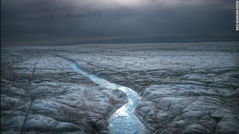
Temperatures at the Greenland summit over the weekend rose above freezing for the third time in less than a decade. The warm air fueled an extreme rain event that dumped 7 billion tons of water on the ice sheet, enough to fill the Reflecting Pool at the National Mall in Washington, DC, nearly 250,000 times.
It was the heaviest rainfall on the ice sheet since record keeping began in 1950, according to the National Snow and Ice Data Center, and the amount of ice mass lost on Sunday was seven times higher than the daily average for this time of year.
Ted Scambos, a senior research scientist at the National Snow and Ice Data Center at the University of Colorado, said this is evidence Greenland is warming rapidly.
“What is going on is not simply a warm decade or two in a wandering climate pattern,” Scambos told CNN. “This is unprecedented.”
The National Science Foundation’s Summit Station is located at the highest point on the Greenland ice sheet, where scientists can observe Arctic weather and changes in the ice. The station has been staffed year-round to observe extreme changes since 1989. The majority of the weekend’s rain fell from the southeast coast of Greenland up to the Summit Station.
Jennifer Mercer, program officer for the Office of Polar Programs at the National Science Foundation, said because of the significant rain event, operations at the Summit Station would need to change: “It means that we need to consider weather events that we have not had to deal with before in the history of our operations there,” she told CNN.
“Increasing weather events including melting, high winds, and now rain, over the last 10 years have occurred outside the range of what is considered normal,” Mercer said. “And these seem to be occurring more and more.”
According to Mercer, the rain will have a lasting effect on the properties of the snow, leaving a crust of ice behind that will absorb more energy from the sun, until it gets buried by snow. Scambos said this crusty layer will also be a barrier that prevents the downward draining of melt water, which will then flood the surface of the ice sheet and initiate run off at higher elevations.
Because of the layer of ice it created, the weekend’s rainfall event “will be visible in ice core records in the future,” Mercer said.