SOURCE: New York Times
DATE: July 19, 2018
SNIP: Aquifers are unimaginably complex and incredibly fragile; once tapped, they can take more than 6,000 years to replenish.
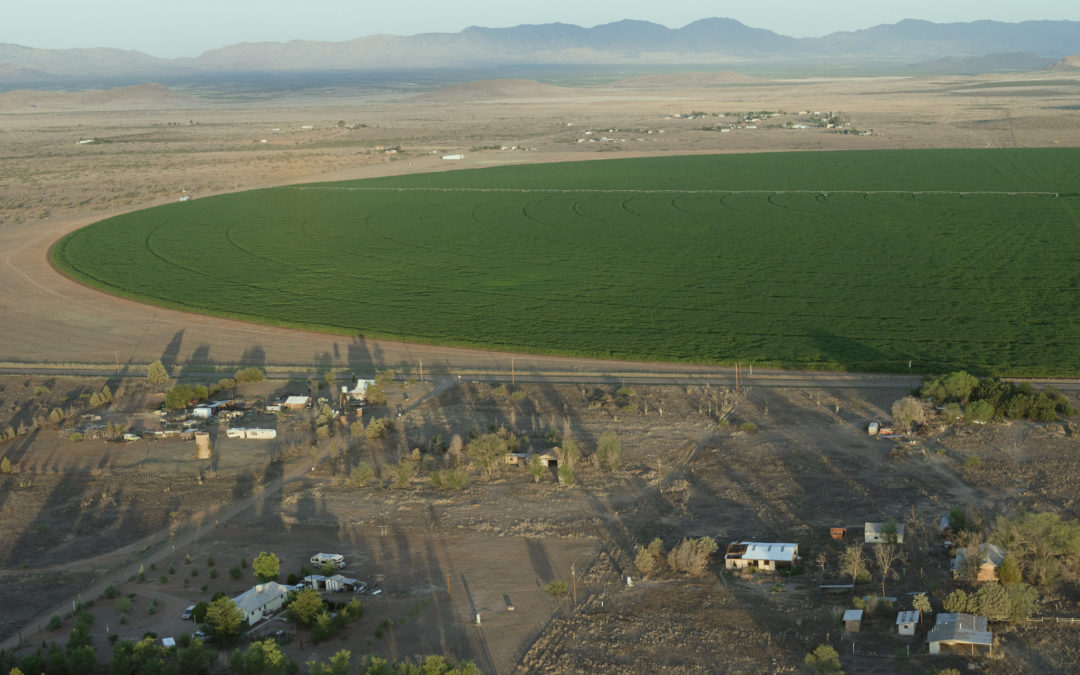
Among the most vulnerable aquifers are those underlying the desert basins of the American Southwest. The Sulphur Springs Valley, in Arizona’s far southeastern corner, is one such basin. Surrounded on three sides by steep mountain ranges, the valley is an unusually flat and level 1,900-square-mile expanse of sagebrush and tanglegrass, which acts as a massive natural vessel for rain and snowmelt. In geological terms, it is a “closed basin,” as none of its water rejoins a river. Instead, it pools at the center, percolating into the ground. Centuries of evaporation have transformed this ancient lake bed into a dry alkali flat, inhabited today by a migratory roost of 30,000 sandhill cranes. Beneath it, buried in layers of sediment, lies all the water that never flowed to the ocean. Some of it is more than 20,000 years old.
Around the turn of the 20th century, when sulfurous water was discovered bubbling out of the ground, cattle ranches and homesteads began to proliferate across the valley. One of the first deep water wells was drilled around 1915, when Texas farmers began adopting the oil industry’s turbine pump. Overnight, this innovation allowed agriculture to stray deep into arid climates, and in the span of a generation, the valley became home to a thriving agricultural economy. In the late 1990s, during the first few years of what would eventually turn out to be a 19-year-and-counting Arizona drought, only about 15,000 acre-feet of water were estimated to have percolated into the aquifer each year, while 100,000 were being pumped out; as the valley continued to warm throughout the 2000s and 2010s, with rainfall and snowmelt plummeting, estimates for recharge went unrecorded, as annual pumping soared to 200,000 acre feet. Once, it had been possible for ranchers to develop natural springs into watering holes using only a shovel. Now, after watching water levels drop 100 to 300 feet in 35 years, some farmers wondered how long they could go on.
Until the last three decades, the technology to make detailed maps of these underground waterways did not readily exist. It wasn’t until 2015, in fact, that NASA published its first comprehensive study of global groundwater reserves. The mission began in 2002, with the launch of the Gravity Recovery and Climate Experiment (Grace), two satellites that follow each other in orbit, measuring changes in gravitational pull. The mission’s primary purpose was to look at ice-sheet depletion, but over the next several years Dr. Jay Famiglietti, the senior water scientist at NASA’s Jet Propulsion Laboratory, and his team noticed that many of the most significant sites of water loss were actually below ground. Of the planet’s 37 major aquifer systems, they discovered, 21 were on the verge of collapse. In the Great Plains, farmers had exhausted a third of Ogallala’s potable water in just 30 years. In California, the Central Valley aquifer was showing signs that it could drop beyond human reach by the middle of this century. But the worst declines were in Asia and the Middle East, where some of the planet’s oldest aquifers were already running out of water. “While we are so busy worrying about the water that we can see,” Famiglietti told me, “the water that we can’t see, the groundwater, is quietly disappearing.”
Squeezed by drought and tightening regulations, large farms started to seek out lesser-known pockets of cheap water. In rural Arizona, where there are essentially no groundwater regulations governing irrigation, they found an ideal destination. “What the smart money is doing is looking around and saying, ‘Where else can we go where there is no regulation?’ ” Robert Glennon, a professor of water law and policy at the University of Arizona and the author of “Water Follies,” told NPR in an interview. “And that is Arizona.”
[Read the whole thing! It’s a fascinating story with unexpected twists…]